My knowledge about the Sundarbans was limited. All I knew was that one has to travel via Kolkata to get there. Of course I had heard about the Royal Bengal Tiger. But there must be more, right? And with this curiosity, I had googled Sundarbans. An image of an impressive labyrinth of green and blue filled my screen. It has been a few years now since then, and I still keep thinking of the place, the people, and their life. I do not want to attempt doing any justice to what I gained from the trip through a few retrospective blogs. The aim is to meander around and into aspects that are not spoken extensively about in the digital space, yet.
This one is a photo story on the various modes of transport in the region.
Leaving The Mainland
The total area of Sundarbans including both land and water is about 10,000 sq km. Out of this, 60% is in Bangladesh and 40% in India. On the Indian side, there are 102 islands out of which 54 islands are inhabited (Lohachara and Suparibhanga are a couple of inhabited islands that have been confirmed to have submerged due to changing sea level and tidal activity causing massive erosion, making the number 52) by humans and the rest 48 are reserved by the forest. Located in the South 24 Parganas district of West Bengal, Sundarbans can be reached by rail or road from Kolkata.
The Indian side of the Sundarbans can be further divided into two.
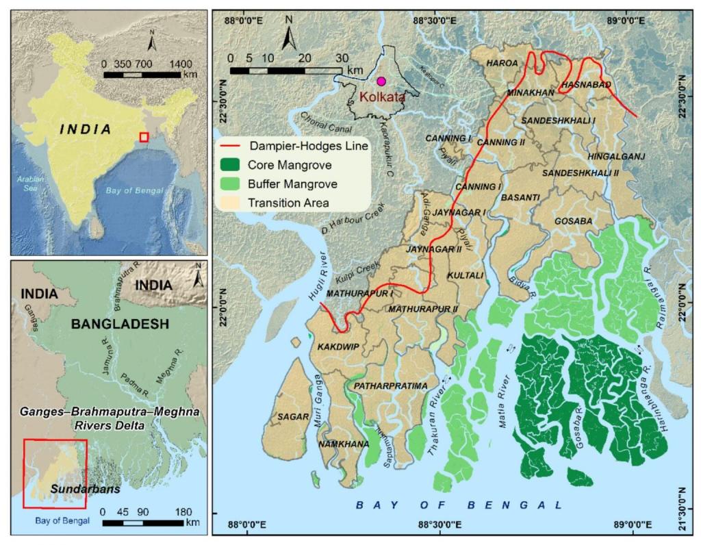
The part closer to the mainland are called ‘up’ islands and some major ones in these are Kakdwip, Basanti, Gosaba, Sagar, Namkhana and Patharpratima. They sit above the core mangrove forest and holds bulk of the population and agriculture. These islands are considered stabler. The area bordering Bangladesh can be reached by traveling to Canning, which further can take us into the ‘down’ islands. The down islands are more volatile, shifting constantly due to silt deposition and erosion. Only few islands here are inhabited. Bali, Jharkhali, Shatjelia, Kumirmari to name some. The rest form the buffer and core forest reserve areas. Beyond a point, typically the buffer zones, the down islands are prohibited for the public to enter.
Image courtesy civilsdaily.com
We took the second route.
There are local trains that run from Sealdah railway station (junction in Kolkata) to Canning. The Sealdah-Canning route connects the metropolitan areas of Kolkata to the outer edges of Sundarbans. Many in the city refer to these local trains as Jhi Special, rather derogatorily, to indicate class and caste markers. ‘Jhi’ is the Bangla word for female domestic workers. They travel every day from the islands of Sundarbans to work in the households of Kolkata. They leave the islands before dawn to reach the designated workplaces in the morning and begin to return in late afternoon from the city to make it to their homes by dusk. Everyday. Built during the early 1860s at the junction of the Bidyadhari and Matla river (Matla from the Bangla word Maataal meaning a drunk man, named to indicate the nature of the river’s flow) was Port Canning. It was named after the then Governor General, Lord Canning. In just a few years of operation, the port was struck by a disastrous cyclone in 1867, devastating the port and the town. The railways do not go any further from here.
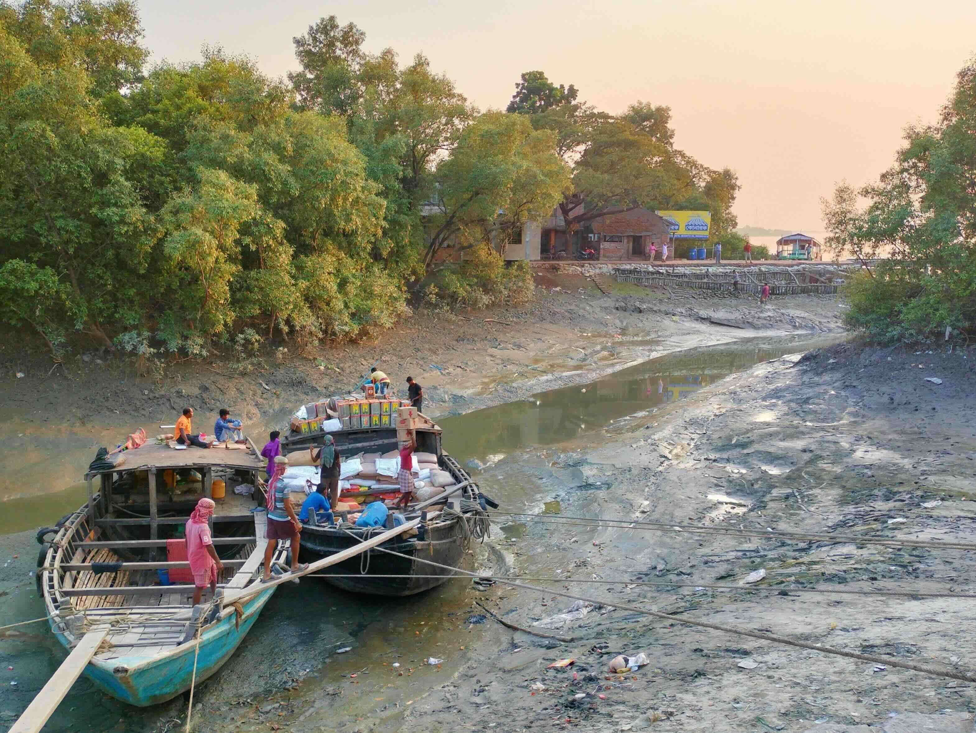
From Canning, one has to travel approx. 30 kms by road to reach either Dhamakhali or Godkhali ferry ghats. We travelled to Godkhali by bus. From the ferry ghat, we took a Bhot-Bhoti that was to take us to Bali island, closer to the buffer zone, where our stay was planned.
Image clicked from the Godhkali ferry ghat, while waiting for our turn.
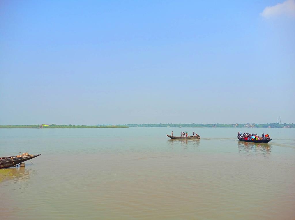
The name Bhot Bhoti is onomatopoeic, originating from the bhut-bhut sound produced by the small diesel engines on which they run. These shallow draft boats are crucial for navigating the narrow creeks and mudflats. And like many other public transport in the country, this one too is overloaded. During the travel, passengers keep changing their positions trying to maintain a balance thus preventing the boat from toppling. They have high center of gravity risks, making them prone to dangers in high tidal waves or strong winds. Slow moving, they are typically constructed from local wood.
A Detour Through a Disclaimer
The Sundarbans is a (i) delta (ii) mangrove (iii) project tiger site (iv) wetland and (v) biosphere reserve.
I will let you explore what each of that means. The truth is that the Sundarbans receives a lot of global attention and resources because of the tiger. It is the largest remaining natural habitat of an estimated 600 Royal Bengal Tigers across both the borders. While it is only an approximation, (as the tigers swim from island to island!) the 48 reserve islands on the India side have about a 100 tigers at any point in time. The people who live here are not as popular as its cohabitant though. Most representations of the people of the Sundarbans is done by clubbing them into one homogeneous group and stripping them of details that ascribe dignity to a community.
Poor, illegally crossing borders, lower caste, absent literacy, cyclone-struck, greedy overfishers, and even grim ones like tiger food; it is a long and arduous story of ecology, history and politics that has given shape to the narratives of the Sundarbans. Often referred to as ‘Nona Joler Manush’ (people of the saline water in Bangla), with over 4.5 million people (when last counted in the census of 2011), this essay is postponing speaking about them to later blogs. This disclaimer is to acknowledge that they are not being overlooked. Albeit, the scope here is restrained to inquire how they commute.
Of Launches and Noukas
This was October 2021, not the best time to be in the Sundarbans really. It had been raining for two days incessantly and there was worry in the air. “They might ask us to shift to the storm centre tomorrow”. Our local hosts informed us. There was a calm alertness to the tone. I remember seeing the storm centre as the only concrete three storey structure on our way to the accommodation in the Bali island. But on the morning of the third day, the sky held up. Overcast, but clearing out. And just like that, our day long Safari outing did not stand cancelled.
“Where are the gypsies? Isn’t it a safari today?”
Asked a rather curious co-traveller
Perhaps some others were also expecting that! To clear the air, the co-ordinators explained with some patience that we are in a delta-wetland. It is not possible for us to walk (or the gypsy tyres to run) in the marshy islands lined with the thorny arial roots of the mangrove trees. During high tides, twice everyday, the mangroves submerge in saline water and the animals huddle around the centre of the island which is generally at a height (think of the islands as an upturned saucer). During low tides, they can be spotted at the shores when they come to the periphery. So we were to pace ourselves according to the tides and at all times we will be in a Launch and observe from its deck.
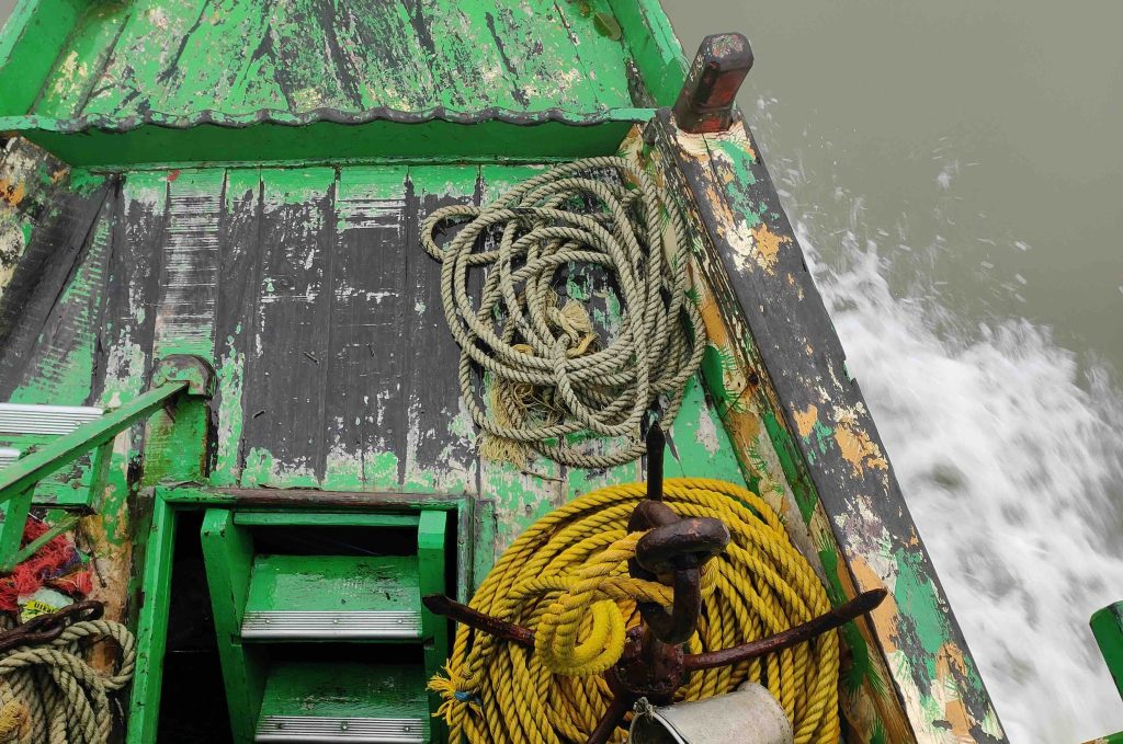
And thus, we met VAGINI NIVEDITA, the launch that belongs to the Sundarban Safari group of the Bali island.
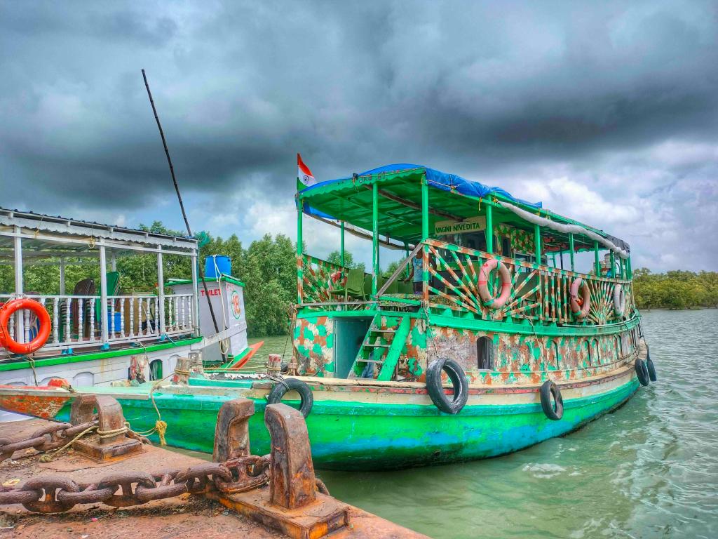
Manufacturing a traditional wooden motorised tourist launch in the Sundarbans typically costs 15 to 20 lakh rupees. A 4-cylinder or 6-cylinder launch with 30 person capacity, involves substantial labor and material costs.They are primarily constructed in boatyards along the rivers, in areas like Canning, Sonakhali, and Pakhiralay, using local high quality, water resistant timber suited for the saline, muddy conditions of the mangrove delta.
The lower deck has a washroom, cooking space, beds and the cylinders that power the launch. The upper deck houses a water tank, dining table with a sink, the pilot’s cabin and viewing deck again. While safaris are the most popular use of the launch, they are also well suited to aid photography and research parties for days together in the water. VAGINI NIVEDITA herself has been used by teams of Indian Space Research Organization, World Wildlife Fund and National Geographic researchers. The co-ordinators would disperse stories all through our interactions of these parties anchoring the launch at the same spot of the rivers meeting or the mouth of a creek, for days. Recording what they were there to record.
For safaris, a day’s tourist permit is issued for each launch by the forest department. At any given day, during the season (the mangrove forest remains shut for tourists for a few months in the year), the permit regulates the number of launches in the water. In recent years, successful measures were taken to curb the plastic pollution these launches were causing by dumping wrappers, cutlery and empty water bottles into the water. When parked, the launch is treated as an extension of the accommodation/stays. The space is handy for storage, using it’s washroom, beds, cooking and dining facilities. The launch however, are not equipped to enter shallow and narrow creeks; the crevices through which one enters the forest. That is left to the Noukas (or Noukos in Bangla).
Noukas are wooden boats, locally made in all the major islands, and are typically used by locals to catch fish and crab from the waters closer to the forest where the yield is higher. Sometimes, they would also be used by honey collectors who dared to venture into the mangrove forest on foot. Accounts of fishers from their expeditions personify the forest and the nouka for the listener, leaving one with a ‘Life Of Pi’ like eerie feeling.
The noukas are the symbol of livelihoods (and hence survival) and safety (your protector when you are by yourself in the forest where the Royal Bengal Tiger looms). The noukas are part of rituals, and the tip is permanently decorated; coloured in red paint, kept clean, not to be stamped by foot and garlanded at all times. Many also share how the nouka is considered a living person and when the profits from a catch is distributed, one share goes for the nouka’s role in the expedition, to the owner. The owner in a few occasion might also be one of the fishers. But mostly they are not a part of the group, but who holds the Boat License Certificate (BLC).
A colonial era construct carried forward after independence, BLC is a mandatory permit issued by the state forest department to fishermen, authorising them to catch within specific, non core areas. It is essential for legal livelihood activities, allowing boats to enter designated, regulated zones only. Without a BLC, fishing in the mangrove forest is considered illegal trespass, and fishermen risk fines, boat confiscation and/or arrest. Furthermore, a valid BLC is required to claim compensation in case of a tiger attack. So, many tiger attacks go unreported due to fear of penalties when discovered that the nouka ventured without BLC. This leads to further fatalities due to lack of prompt reporting to the forest department who can send help. Especially after Project Tiger was initiated in 1973, the regulation on forest produce collection grew stricter. New BLCs are not sanctioned anymore. So the older ones are circulating and often passed on or rented. A BLC’s annual rent can be as high as 30 thousand rupees. Gradually, from being owned by legit poor fishermen to who it was originally sanctioned, BLCs are now rented by those who can afford to (growingly by smaller traders who live in Canning and beyond in the mainland) and local fishermen work for them. Think of it akin to farm labour, where the labour is of the people. But the capital and resources is owned by a few affluent people.
Noukas also come in some varieties. From the small ones, only sufficient for upto 3 persons and hand rowed, to sightly bigger ones that can accommodate 5-6 fishers, store the catch and fitted with a diesel run motor. Until they reach the end of the waters where motorized boats are permitted from their home islands, they use the motor; then switch to manual rowing. This helps reduce the complete round trip duration by a couple of days. Once inside the buffer, all noukas are mandated to cut the motor.
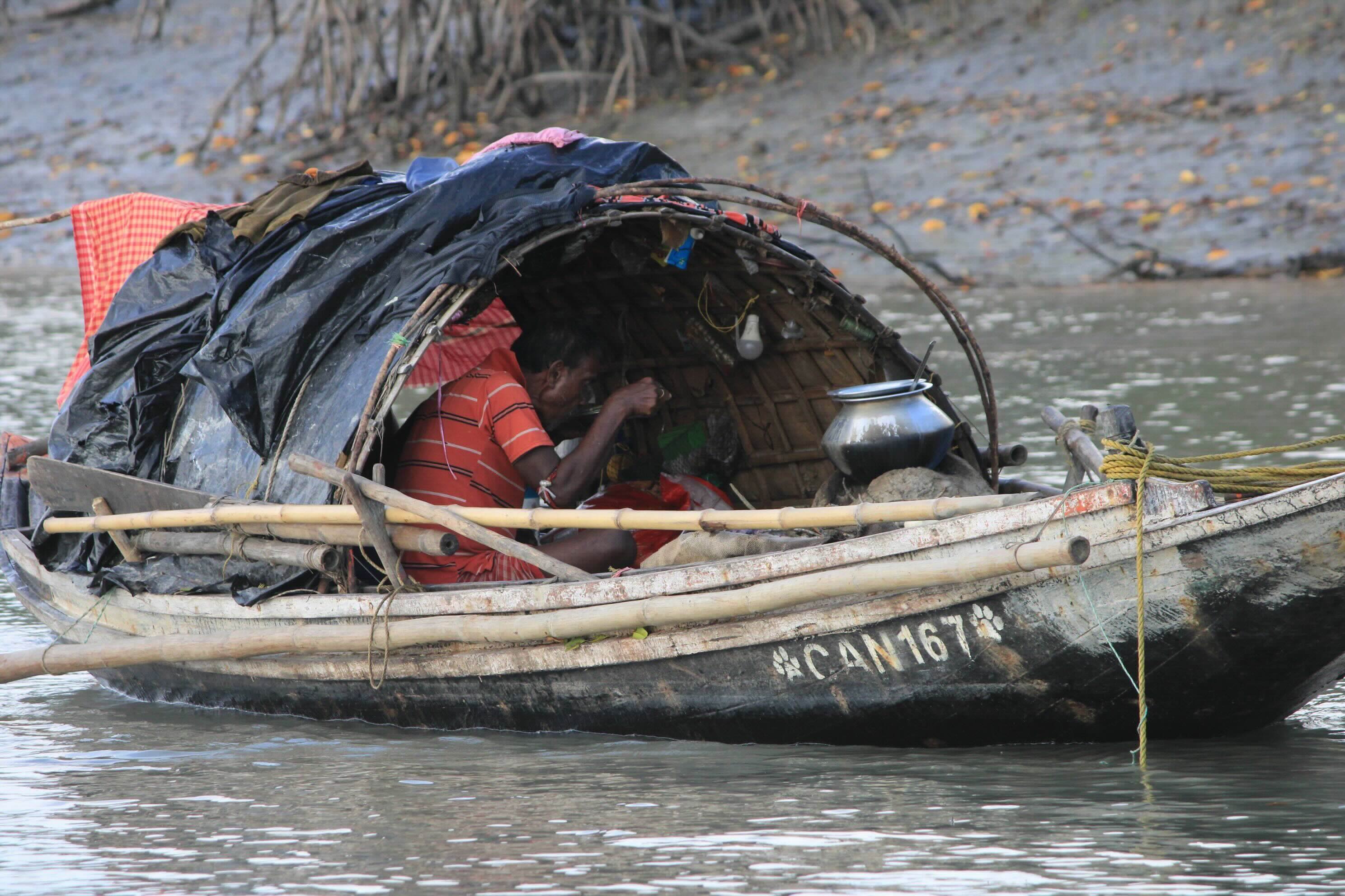
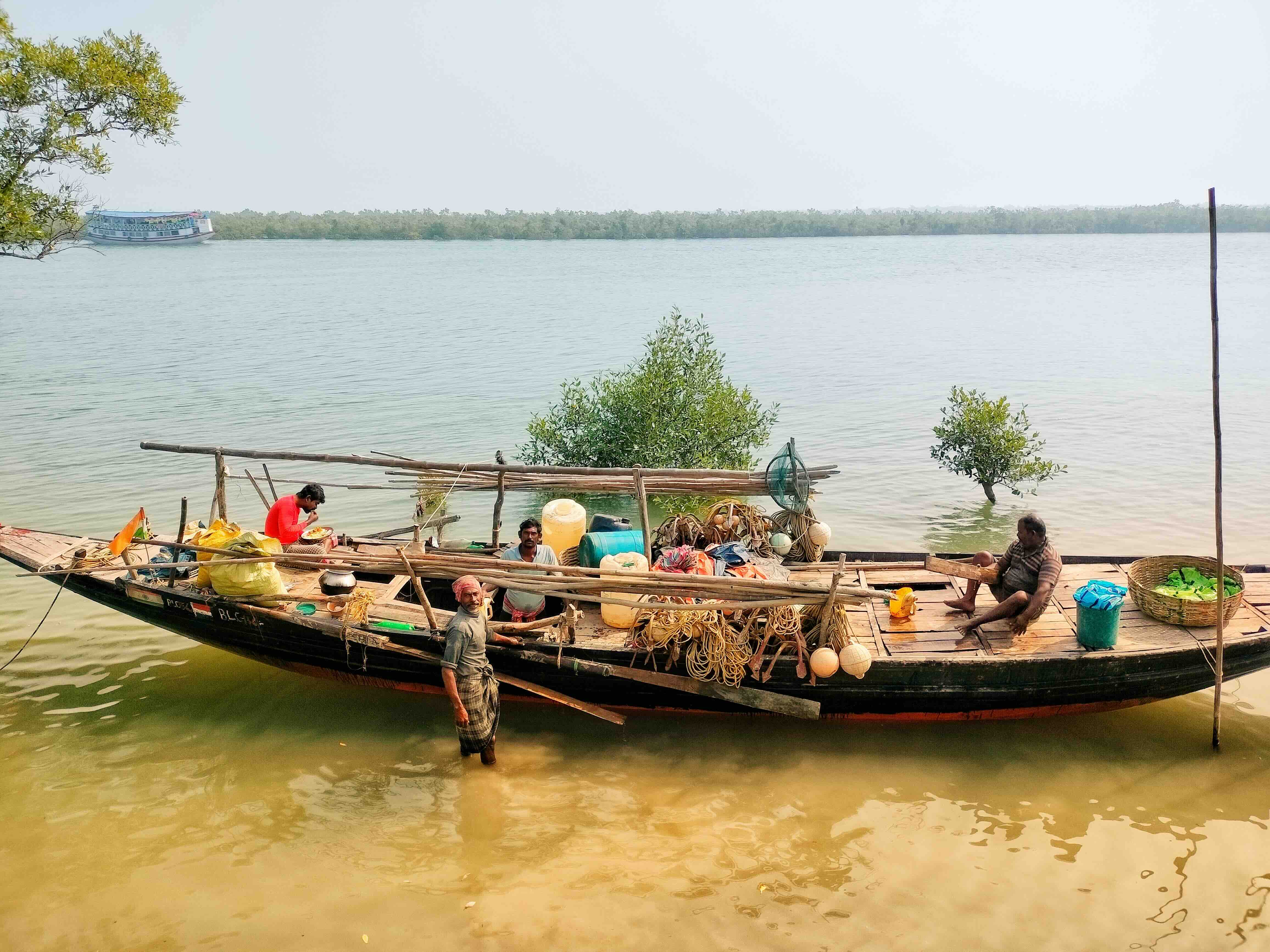
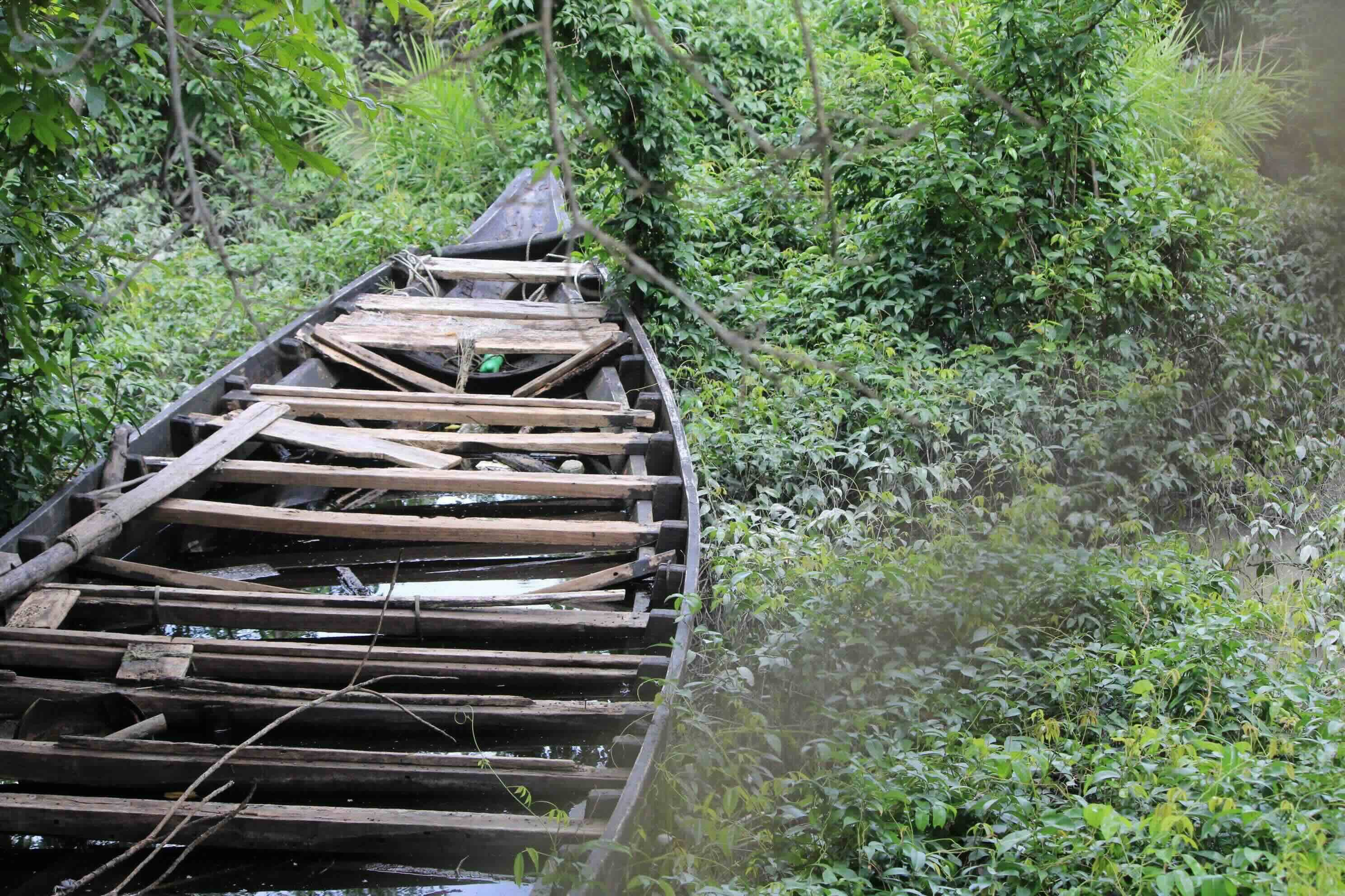
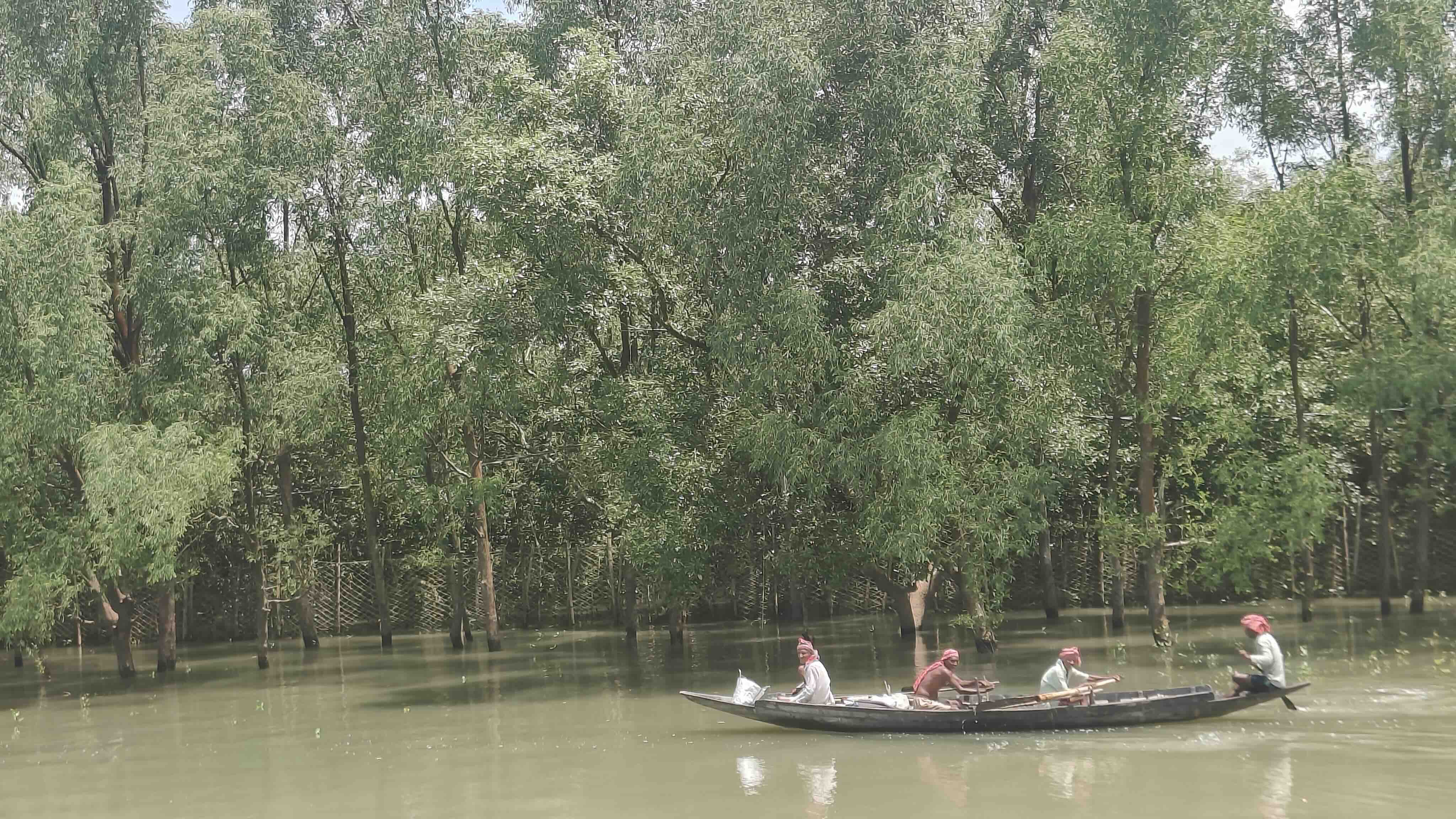
From top left, clockwise - A fisherman completes his meal in the nouka, with the cooking setup and a light bulb dangling nearby. A fishing party loads their week long supplies of nets, ice boxes, pots, pans and buckets, cooking stove, ropes and anchor into the nouka as they venture out. A nouka confiscated for fishing without a BLC stands abandoned in the premise of the forest range office in Dobaki. Finally, an image clicked by Snehanshu Shome of four boatmen rowing a nouka with the forest in the backdrop. The net installed by the forest department marks the boundary between the human inhabited and forest reserve areas
In Deep Waters
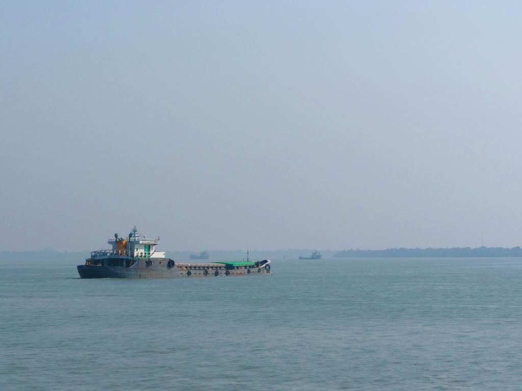
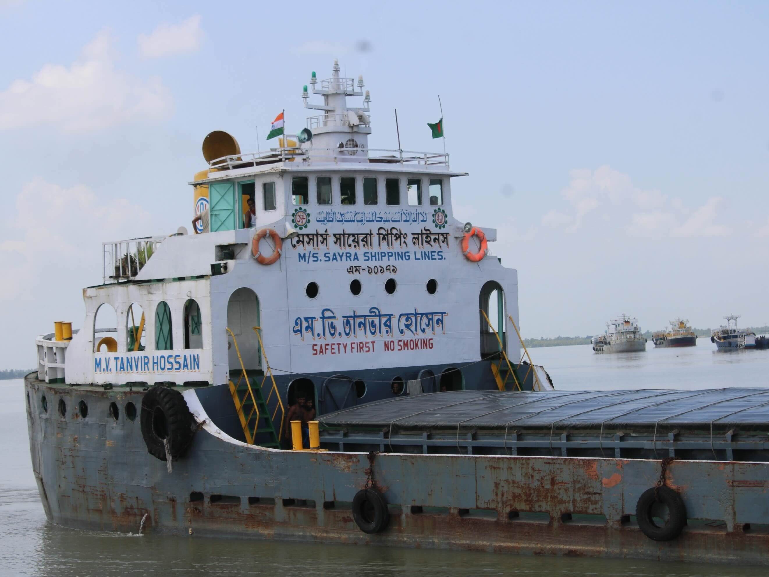
While not a part of everyday life, it is certainly a sight common in the Sundarban down islands, nearer to the Bangladesh border. Large fishing trolleys are not a sight here, where the environmental regulation are strict. Fishing in buffer areas via traditional methods, like the one described above are only done. India exports approximately three million tons of fly-ash annually to Bangladesh for cement manufacturing, primarily using inland waterway Barges along the Indo-Bangladesh Protocol (IBP) routes. Vessels operate from ports of West Bengal to Bangladesh, often carrying 500-1500 metric ton per fly-ashtrip. These shipments frequently suffer from safety issues like sinking and environmental concerns due to the use of older, sometimes unseaworthy vessels.
A barge is a long, flat-bottomed boat used primarily for transporting heavy goods like coal, grain, sand and construction material along rivers, canals, and in harbours. As a verb, ‘barge’ means to move clumsily or rudely, often interrupting or entering a space suddenly. As one approaches the border from the India side Sundarban, it is common to see many of these barges anchored near the water border to either enter into Bangladesh or returning from there, awaiting their turn to be inspected.
For The Amphibious
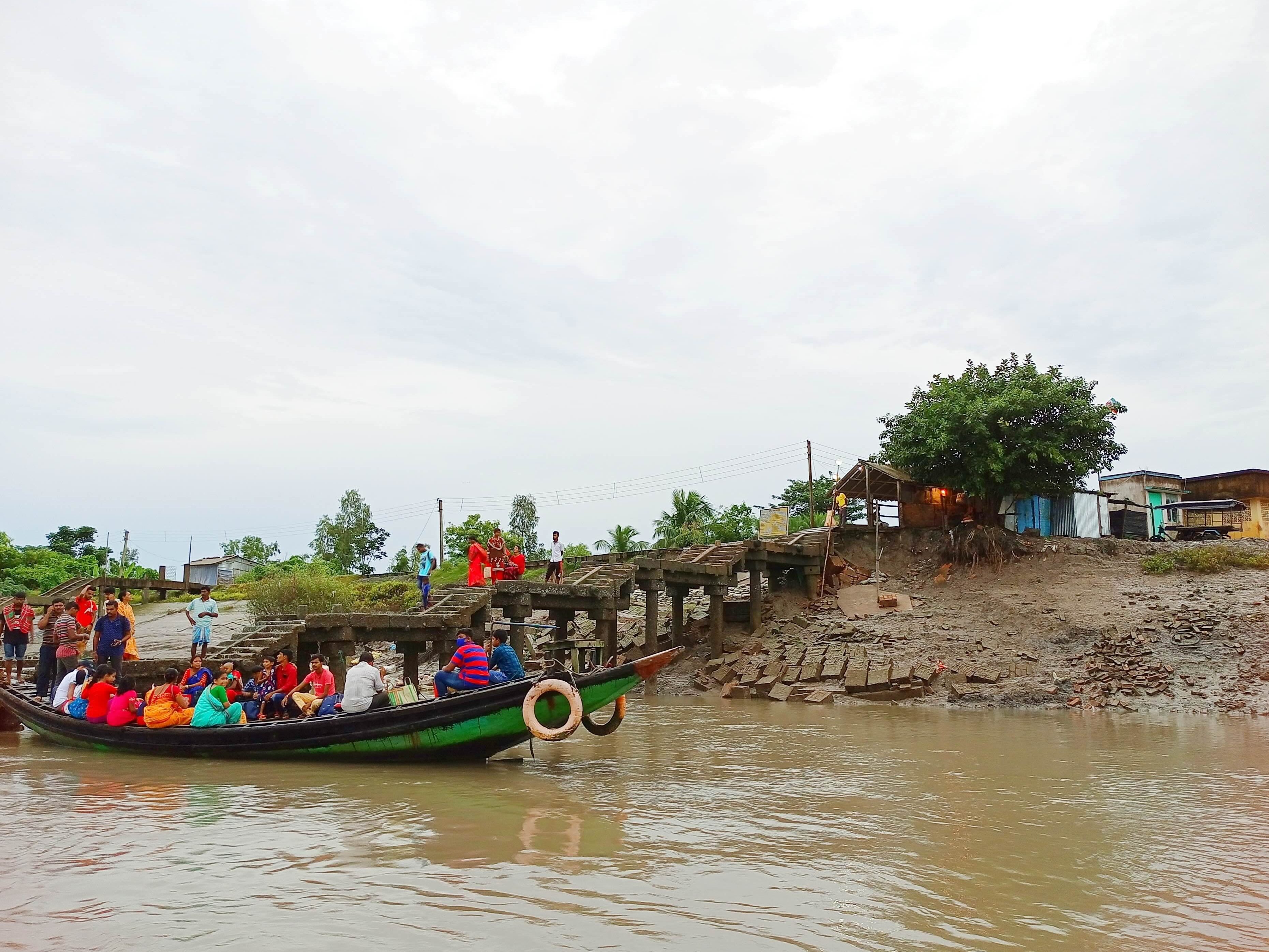
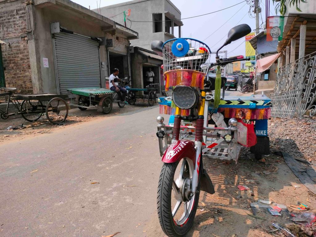
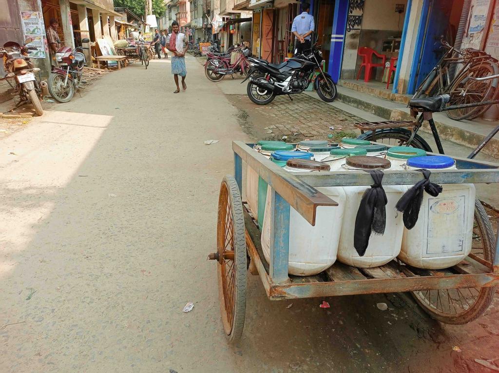
So far, for those who have not visited or read/seen about the region on digital media, there is land too. Not the highway and flyover type. But the mud lanes and village road type. The intra island transport changes rapidly as one moves from Canning to the buffer region. First, the motorised four wheeler disappears. In most of the down islands, they are prohibited. Then the three wheeler auto rickshaws stop. They are replaced by battery operated e-Rickshaws which are on the rise. Bali island itself, with a population of approximately forty thousand across fifteen villages, has nearly two hundred of them now. They also boost of the newly formed e-rickshaw union in the island (of course!)
And finally, they are replaced by the lifeline of intra island traverse in the down islands – the motorized Van-garis. These are modified cycle rickshaws with diesel engines or batteries and a wooden plank on which six to seven passengers can sit at a time. They can also be modified to have a tarpaulin roof to save from heat and rain.
As the sun begins to set, activities move from the field and waters and roads and ferry ghats inside the modest houses of the people. Like it should be in a fragile ecosystem where the people are seen as ‘disturbing’ the wilderness. Those out into the sea retreat near the creeks where they drop anchor and park their noukas and launches. Those on land, move into their homes, often made of straw and mud and in recent times with bricks and cement, with the children and domesticated animals. The e-rickshaws and vans stop and stay put in their designated spots. If you are at the peripheri, sound of the tides crashing against the embankments play in sync with the crickets’ calls. If you have the comfort of being in the interior, the sound from a nearby temple’s loudspeaker playing the Mansa Mangal or Bonobibi Johurnama dominates.
How many days would your social self survive, where every visit must be planned around seasons, tides and permits? Where a short errand isn’t a quick walk or ride. Think of the ease with which you step out for coffee, or summon a cab without a second thought. Here, even the simplest journeys demand time, patience, and resilience. Convenience, as you know it, quietly dissolves into effort. And perhaps, in that contrast, lies a question worth carrying back home.
“How much of your life is shaped by access, and how often do you stop to notice it?“

Further Reads & References
- Forest of Tiger is a wholesome read on the region, by Annu Jalais, published by Abingdon: Routledge, 2010
- An article on Boat License Certificate by Meghnaa Mehtta in the online journal The India Forum, 2021
- Know more about Project Tiger here
- Know more about fly-ash trade between India and Bangladesh by Rishika Pardikar in the Dialogue Earth portal
Joint story by Pranoti Monde and Anupama Pain, who were part of a ten day travel workshop to the Sundarbans. The photographs (where no credits are mentioned, including the cover photo) are clicked by Anupama.

Will love to hear your thoughts on the topic here